Tuesday's weather forecast for Mansfield and Ashfield as Storm Franklin retreats
and live on Freeview channel 276
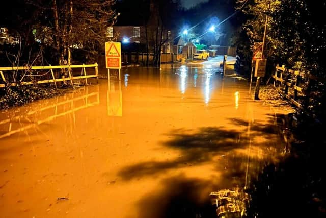
Severe weather and flood warnings have dominated the headlines in the past week, with high winds, risk to life and flooding all forecast in the area in the past seven days.
Storms Dudley, Eunice and Franklin brought with them gale-force winds and flooding, with a number of major roads in the area closed due to fallen trees, however as Storm Franklin’s area of low pressure moves away from the area, we will be left with blustery winds and rain showers for the rest of the day.
Advertisement
Hide AdAdvertisement
Hide AdMet Office forecasters say: “A band of heavy rain and strong gusts moves southeast this morning, clearing by midday to sunny spells and the odd isolated shower.

"Turning cooler, with blustery winds, particularly over high ground, we will see a maximum temperature of eleven degrees.
"It will be partly clear this evening with patchy cloud and gusty winds, and it will become clear and cold overnight as winds strengthen once again toward dawn."
A flood alert had previously been issued for parts of Mansfield as water levels increased with the weekend’s heavy rain, with drivers issued with the advice to avoid low-level roads near to rivers, however the information has now been updated to confirm that the flood alert has been removed for the time being.
Advertisement
Hide AdAdvertisement
Hide AdIt said: "River levels have now fallen below the flood risk threshold.
"Further light rainfall is forecast over the next 24 hours.
"We will continue to monitor the forecast and re-issue this alert if necessary.”
