
Yellow warning for thunderstorms in Nottinghamshire and Derbyshire following sizzling heatwave
The Met Office has issued a yellow warning for thunderstorms for two days after the country bakes in what are forecast to be the hottest days of the year so far.
Following the sizzling heatwave, the yellow warning is in place from midnight on Monday until 23.59pm on Tuesday.
It comes as temperatures across the UK continue to rise on what could be the hottest day of the year so far with 31C forecast in the East Midlands today.
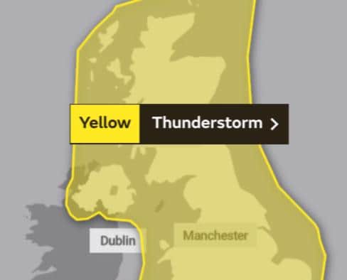

Some places are likely to see severe thunderstorms early next week - but there is significant uncertainty in location and timing.
What to expect:
There is a small chance that homes and businesses could be flooded quickly, with damage to some buildings from floodwater, lightning strikes and large hail.
Where flooding or lightning strikes occur, there is a chance of delays and some cancellations to public transport.
Spray and sudden flooding could lead to difficult driving conditions and increased chance of accidents.
There is a slight chance that power cuts could occur and other services to some homes and businesses could be lost
There is a small chance of fast flowing or deep floodwater causing danger to life.
Today: It will be hot by afternoon, but a little cooler near coasts with onshore sea breezes. Showers possible in the evening. Maximum temperature 31 °C.
Tonight will be a mainly fine evening but chance of showers. Areas of low cloud and mist may develop overnight, especially across the Derbyshire hills. Minimum temperature 18 °C.